
KYUSHU
Ramen & Yatai: Tonkotsu ramen was born in Kurume, in Fukuoka Prefecture, and Hakata made the thin-noodle, milky-pork-broth style famous. Yatai food stalls line the Nakasu riverbank each evening. The city centre is walkable.
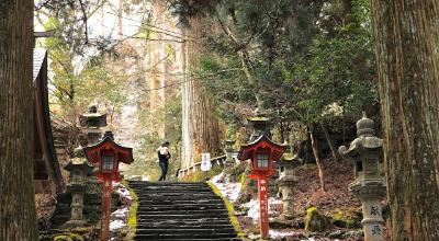
Dazaifu: Dazaifu Tenmangu was founded in 905 CE over the grave of scholar Sugawara no Michizane, set among some 6,000 plum trees, about 30 minutes by rail from Fukuoka. Canal City Hakata is a large shopping and entertainment complex built along a canal in the city centre.
-
Nakasu YataiRiverside food stalls from early evening. Seats are few: eat, then make room.📍 Google Maps
-
Dazaifu TenmanguShrine of learning among plum trees, blooming Feb–Mar. Kyushu National Museum next door.📍 Google Maps
-
Kushida ShrineHakata's guardian shrine; a towering Yamakasa festival float is on show year-round.📍 Google Maps
-
Ohori ParkLake park beside the Fukuoka Castle ruins; climb the old walls for city views.📍 Google Maps
-
ItoshimaCoastal drive to a white torii before the "wedded rocks" of Futamigaura, about 40 min west.📍 Google Maps
Beppu: Beppu has thousands of hot spring sources and the largest hot-spring output in Japan. The Jigoku Meguri tour visits seven volcanic "hells" including cobalt-blue Umi Jigoku and blood-red Chinoike Jigoku.
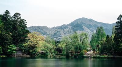
Yufuin: Yufuin is a valley town known for craft galleries and local food. Lake Kinrinko sits at its centre, with Mt. Yufu visible to the north. Under an hour from Beppu by road.
-
Beppu Jigoku MeguriSeven "hells" of boiling water; cobalt Umi and blood-red Chinoike are the stars.📍 Google Maps
-
Yufuin & Lake KinrinkoCraft-town streets and a lake steaming with morning mist in autumn and winter.📍 Google Maps
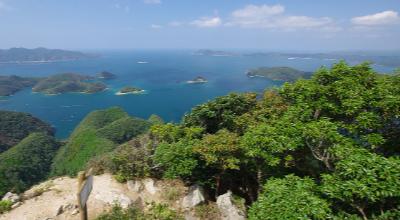
Watatsumi Shrine: Watatsumi Shrine has a vermillion torii gate standing in a tidal inlet, surrounded by dense forest on all sides. The island is isolated enough that arriving feels like a transition.
Wildlife & History: The Tsushima leopard cat is endemic to the island and listed as critically endangered. Kaneda Castle's stone walls date to 667, built against a feared Tang–Silla invasion; the Mongols landed at Komoda Beach in 1274. Jetfoil from Hakata Port: about 2¼ hours.
-
Korea ObservatoryNorthern tip lookout; Busan is visible across the strait on clear days.📍 Google Maps
-
Wildlife Conservation CenterMeet the endangered Tsushima leopard cat. Check opening days first.📍 Google Maps
-
Tsutsu CapeQuiet southern tip of the island, with open-sea views and a small fishing village.📍 Google Maps
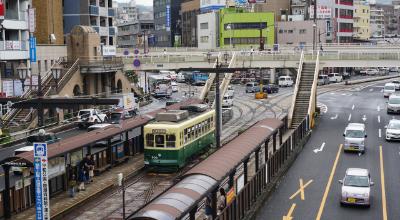
Port History: During the Edo period, Nagasaki was Japan's only port open to Dutch and Chinese trade — its window on the world. Portuguese, Chinese, and Dutch influence is visible in the city's architecture, food, and street layout.
Gunkanjima: Gunkanjima (Hashima Island) was a coal mining community of over 5,000 residents at its peak, abandoned in 1974 when the mine closed. Now a UNESCO World Heritage site reachable by ferry. The Atomic Bomb Museum documents the August 9, 1945 bombing.
-
GunkanjimaBoat tour to the abandoned "Battleship Island." Landings happen only in calm seas.📍 Google Maps
-
Atomic Bomb MuseumMuseum of the August 9, 1945 bombing, with Peace Park and the hypocenter nearby.📍 Google Maps
-
Glover GardenHillside merchant houses, including Japan's oldest Western-style wooden house.📍 Google Maps
-
Oura CathedralJapan's oldest standing church (1864), a National Treasure and UNESCO site.📍 Google Maps
Mt. Aso: Mt. Aso has one of the largest calderas in the world. Active vents sit at the Nakadake crater, which opens and closes to visitors depending on volcanic gas levels. Wild horses graze the Kusasenri grassland plateau within the caldera.
Castle & Onsen: Kumamoto Castle was completed in 1607. The main keep is a 1960 concrete reconstruction; 13 original structures remain as Important Cultural Properties. After the 2016 earthquakes the keep reopened inside in 2021; repairs to walls and turrets will run for decades. Kurokawa Onsen is a hot spring village in the mountains north of Aso.
-
Mt. Aso Nakadake CraterSteaming turquoise crater lake. Access closes when gas levels rise; check before going.📍 Google Maps
-
Kurokawa OnsenRiverside onsen village; a wooden pass gets you into three outdoor baths.📍 Google Maps
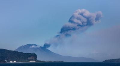
Sakurajima: Sakurajima is an active stratovolcano with frequent eruptions. A 15-minute ferry from Kagoshima city reaches it — lava from the 1914 eruption joined the former island to the mainland.
Sengan-en & Chiran: Sengan-en is a traditional Japanese garden built by the Shimazu clan in 1658, with Sakurajima visible across the bay. Chiran preserves seven samurai garden residences from the Edo period.
-
Sakurajima24-hour ferry, 15 minutes. Walk the lava trail and soak in the seaside foot bath.📍 Google Maps
-
Sengan-enShimazu clan garden framing Sakurajima; UNESCO-listed Shoko Shuseikan next door.📍 Google Maps
-
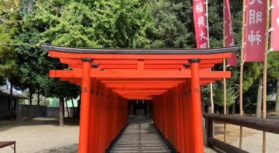
Kirishima JinguVermilion shrine among giant cedars in the volcanic Kirishima mountains.📍 Google Maps
-
Satsuma-IojimaVolcanic island with seaside hot springs. About 4 hrs by ferry, only a few sailings a week.📍 Google Maps
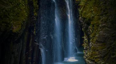
Takachiho Gorge: Takachiho Gorge is cut through basalt columns formed by ancient lava flows. Manai Falls drops 17 metres into the river. Rowboats can be rented at the base of the gorge — book ahead in busy seasons.
Sacred Cave: Amano Yasukawara is a shrine inside a riverside cave, its floor covered with stone cairns stacked by visitors over generations. The Nichinan Coast to the south is a stretch of sea cliffs, rock formations, and subtropical shoreline.
-
Takachiho GorgeRow beneath Manai Falls between basalt walls. Book ahead; no boats after heavy rain.📍 Google Maps
-
Takachiho YokaguraHour-long night kagura dance at Takachiho Shrine, every evening at 8pm.📍 Google Maps
-
Amano Iwato & YasukawaraShrine to the sun goddess's cave, then a riverside cave filled with stone cairns.📍 Google Maps
Arita: Arita has produced porcelain since 1616, when kaolin clay was first discovered nearby. Kilns in the town are open to visitors. Yoshinogari Historical Park preserves a Yayoi-period settlement dating to around 400 BCE.
Balloon Fiesta: The Saga International Balloon Fiesta, held each year from late October into early November, draws over 100 balloons to the Kase River floodplain. One of the largest balloon events in Asia.
-
AritaPorcelain town since 1616; see the Izumiyama clay quarry. Pottery fair at Golden Week.📍 Google Maps
-
Yoshinogari Historical ParkRebuilt moated Yayoi village with watchtowers and thatched halls.📍 Google Maps
-
Saga Balloon FiestaOver 100 balloons at dawn, late Oct–early Nov. A temporary station opens for it.📍 Google Maps
-
Yutoku Inari ShrineOne of Japan's three great Inari shrines, built up a cliff on stilts.📍 Google Maps
-
Takeo OnsenSoak behind the vermilion 1915 gate by Tatsuno Kingo, architect of Tokyo Station.📍 Google Maps
-
Karatsu CastleRebuilt castle above the Niji-no-Matsubara pine grove; Karatsu Kunchi is Nov 2–4.📍 Google Maps
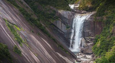
Ancient Forest: Yakushima's cedar forest is UNESCO-listed. Jomon Sugi, the island's largest and oldest known cedar, is estimated at 2,170–7,200 years old — reaching it is a 10–11 hour round-trip hike. The island receives among the highest annual rainfall in Japan.
Shiratani & Coast: Shiratani Unsuikyo is a forest ravine with dense moss cover and cedar trails. Yakushima's beaches serve as nesting sites for loggerhead sea turtles from May to July.
-
Jomon Sugi10–11 hour round-trip hike; start before dawn. Seasonal shuttle bus to the Arakawa trailhead.📍 Google Maps
-
Shiratani UnsuikyoMoss-covered ravine said to have inspired Princess Mononoke's forest.📍 Google Maps
-
Nagata InakahamaJapan's top loggerhead turtle nesting beach; guided night viewing May–July.📍 Google Maps