Best of by 

OKINAWA TRIP | JAPAN.GG
Okinawa was the independent Ryukyu Kingdom for more than four centuries before Japan annexed it in 1879. The language, food, castle architecture, and music all developed separately from the Japanese mainland. The archipelago stretches 1,000 km southwest of Kyushu — 160 subtropical islands surrounded by reef systems. The outer islands — Kerama, Miyako, Ishigaki, Iriomote — have a distinct culture, ecology, and pace of life.
☄️ GRAND SLAM GETAWAY 🛫
DIAMOND
The Best Islands of Okinawa: 📍 Shuri Castle. 📍 Blue Cave, Cape Maeda. 📍 Peace Memorial Museum.
Shuri Castle: Palace of the Ryukyu Kingdom, UNESCO-listed. The 1992 reconstruction caught fire October 31, 2019, destroying the main Seiden hall. Restoration ongoing; grounds remain open.
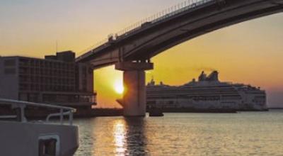
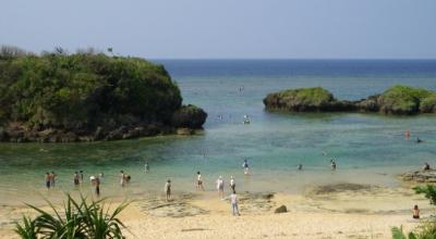
Blue Cave & Naha: The Blue Cave at Cape Maeda fills with blue light through its underwater entrance — snorkelling tours depart daily, no certification required. Old Makishi public market off Kokusai Dori is worth exploring.
Battle of Okinawa: April–June 1945. The Prefectural Peace Memorial Museum at Itoman covers it in both languages with notable directness.
PLATINUM
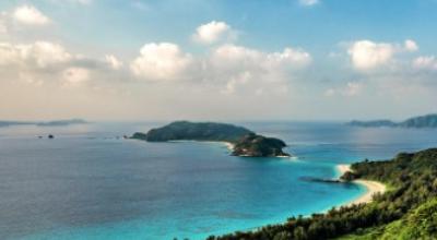
The Best Islands of Okinawa: 📍 Zamami Island. 📍 Tokashiki Island. 📍 Furuzamami Beach.
Kerama Blue: 40 km west of Naha. Water clarity regularly exceeds 30 metres horizontal visibility. High-speed ferry from Tomari Port: 50–70 minutes to Zamami.
Sea Turtles & Whales: Zamami and Tokashiki host one of Japan's largest loggerhead sea turtle nesting grounds — females ashore May through August. Humpback whales use the Kerama channel as a breeding ground from late December through March.
GOLD
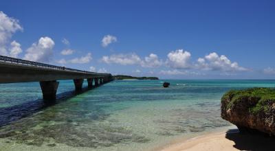
The Best Islands of Okinawa: 📍 Yonaha Maehama Beach. 📍 Irabu Bridge. 📍 Tōri-ike Marine Lakes.
Yonaha Maehama: Seven kilometres of coral-white sand, west-facing and shallow — frequently ranked Japan's best beach. Flight from Naha: 45 minutes.
Irabu Bridge & Marine Lakes: Japan's longest toll-free bridge at 3,540 metres connects Miyako to Irabu Island. The Tōri-ike marine lakes on Shimoji exchange water with the open ocean through submerged tunnels — unique dive conditions. Miyako soba (flat wheat noodles, pork-and-fish broth) is distinct from Okinawan soba.
The Best Islands of Okinawa: 📍 Kabira Bay. 📍 Manta Scramble. 📍 Taketomi Island.
Kabira Bay: Protected black pearl farm on Ishigaki's northwest coast — swimming prohibited, glass-bottom boat tours depart regularly. Pearl cultivation on site dates to the 1950s.
Manta Scramble & Yaeyama: Year-round manta ray encounters at a cleaning station — reliable enough that operators offer manta guarantees. Ferry hub for the Yaeyama islands: Taketomi (10 min), Iriomote (40 min), Yonaguni by flight.
The Best Islands of Okinawa: 📍 Urauchi River. 📍 Mariyudo Falls. 📍 Yubu Island.
The Jungle: 90% intact subtropical forest — the highest proportion on any inhabited island in Japan. No traffic lights, one incomplete road. UNESCO World Heritage listed in 2021.
Iriomote Wildcat & Urauchi River: The Iriomote wildcat (Prionailurus bengalensis iriomotensis) exists nowhere else on Earth — ~100 individuals estimated. Urauchi River kayaking through mangrove forest reaches Mariyudo and Kampire waterfalls in about one hour.